

Real Estate Drone Videography Services in Islamabad 2026
A buyer decides whether a property is worth visiting before they leave their house. In 2026, the listings that stop the scroll are the ones with aerial video showing the property, its surroundings, its access, and its context in one compelling sequence.
Most real estate listings in Islamabad still rely on flat interior photographs that show nothing about where the property sits or why the location matters. That gap is exactly where real estate drone videography creates immediate value.
This guide covers drone photography and videography services for real estate in Islamabad in 2026: what aerial video delivers, which companies to hire, the legal requirements, and what things cost. For photography and videography services that include licensed real estate drone production, Hamza’s Production is Pakistan’s most capable option.
Table of Contents
Why Aerial Video Changes Real Estate Marketing in Islamabad
Ground-level photography shows a room. Aerial video shows a property’s place in the world. For buyers making decisions involving tens of millions of rupees, that difference matters enormously.
Forbes research shows that real estate listings with aerial video generate more enquiries and sell faster than comparable listings using ground photography alone. In Islamabad, where location value is defined by sector, proximity to the Margalla Hills, and access to institutional hubs, showing that context visually is among the most persuasive things a listing can do. Zameen.com, Pakistan’s most active property platform, has seen consistent growth in video-enabled listings as buyers expect more than static images before visiting.
Who Uses Real Estate Drone Videography in Islamabad
Housing society developers in DHA Islamabad, Bahria Town, and Capital Smart City use aerial footage to market large-scale developments to domestic and overseas buyers. A housing society covering hundreds of kanals cannot be represented by a ground-level photograph. Aerial footage shows the masterplan, infrastructure, and surroundings in a single shot.
Commercial developers use drone footage for office parks and mixed-use developments where location and visibility are primary selling points. Property agents use aerial footage for premium residential listings where plot size and street context affect buyer interest. Construction firms use regular aerial surveys for progress documentation. Architectural firms document completed projects from the air to show design intent.
What Real Estate Drone Videography Covers
Aerial Property Overview Shots
An overhead shot directly above the property shows the plot boundaries, building footprint, and the relationship between structure and land. For plot buyers and investors, this view communicates scale and proportion more clearly than any floor plan.
Orbiting and Reveal Shots
An orbiting shot circles the property at a consistent height, showing all four elevations in one continuous movement. A reveal shot approaches from a distance, rises over the property, and turns to face the Margalla Hills or the city, creating a cinematic opening that communicates setting before the buyer has consciously processed it.
Location and Neighbourhood Context
Wide aerial shots show road access, neighbouring developments, and proximity to commercial areas and parks. For Islamabad properties in E-7, F-6, and G-11, neighbourhood context is a significant part of the value proposition that written descriptions never convey.
Construction Progress Documentation
Developers use monthly aerial surveys to document site progress for investors and financiers. A time-series from groundbreaking through to handover demonstrates delivery credibility for future project phases in a way that a printed brochure cannot.
Housing Society Master Plan Footage
Large housing societies use aerial footage to show the master plan in its physical context: the road network, green belts, commercial zones, and residential blocks as they actually exist. Buyers who have only seen a printed master plan respond differently when they see the same layout from 100 metres above the actual site.
Interior to Exterior Transition Shots
A low-altitude shot that begins just outside a property entrance and rises to reveal the full plot connects interior footage to aerial context seamlessly. This technique produces listing videos that feel cinematic rather than a collection of separate clips edited together.
Islamabad Real Estate and Drone Videography: Why This City Is Different
Islamabad is both one of the most aerially photogenic cities in Pakistan and one of the most technically challenging for drone operations.
The Margalla Hills create a backdrop that adds genuine visual value to northern sector properties. A plot in E-7 or F-6 photographed from the air with the Hills in frame communicates natural beauty and premium location in a single image. Properties along the Islamabad Expressway show their connectivity to Rawalpindi in an aerial perspective no ground shot can replicate.
At the same time, Islamabad contains some of the most strictly regulated airspace in Pakistan. The presidency, parliament, foreign embassies, and military installations sit within or adjacent to residential and commercial sectors. Restricted zones are extensive and not always obvious from a map, making licensed drone operations more critical here than in any other Pakistani city.
CAA Drone Regulations for Real Estate in Islamabad
The Civil Aviation Authority of Pakistan (CAA) regulates all commercial drone operations nationally. Commercial drone flights require CAA operator certification and in many cases location-specific permits before any flight takes place.
In Islamabad, the permit requirement is not optional. Unlicensed drone flights carry real legal consequences including equipment confiscation and prosecution. Even in areas that appear unrestricted, proximity to government zones or military infrastructure can trigger restrictions an unlicensed operator has no way to check.
A licensed company manages the full permit process for the client. They know which zones need specific permissions and how to schedule shoots around approval timelines. Permits typically take five to ten working days for standard locations and longer for areas needing additional clearance.
Never commission a drone shoot in Islamabad from an operator who does not raise the permit question themselves. A company that does not mention CAA compliance unprompted is not operating legally.
What Makes Real Estate Drone Videography Actually Work
Timing: Light Conditions and Golden Hour
Golden hour, the 30 to 60 minutes after sunrise and before sunset, produces warm, directional light that makes properties look their best from the air. Digital Photography School identifies golden hour as the most impactful variable in outdoor property photography at any altitude. Midday light in Islamabad produces harsh, flat footage with washed-out tones. Always plan drone shoots around golden hour windows.
Flight Planning and Shot Sequencing
A professional operator plans the shot sequence before arriving on site. They know which direction to approach for the reveal shot, where to orbit to keep the Hills in frame, and how high to fly for the master plan overview. Unplanned shoots produce random footage that requires excessive editing to sequence into anything usable.
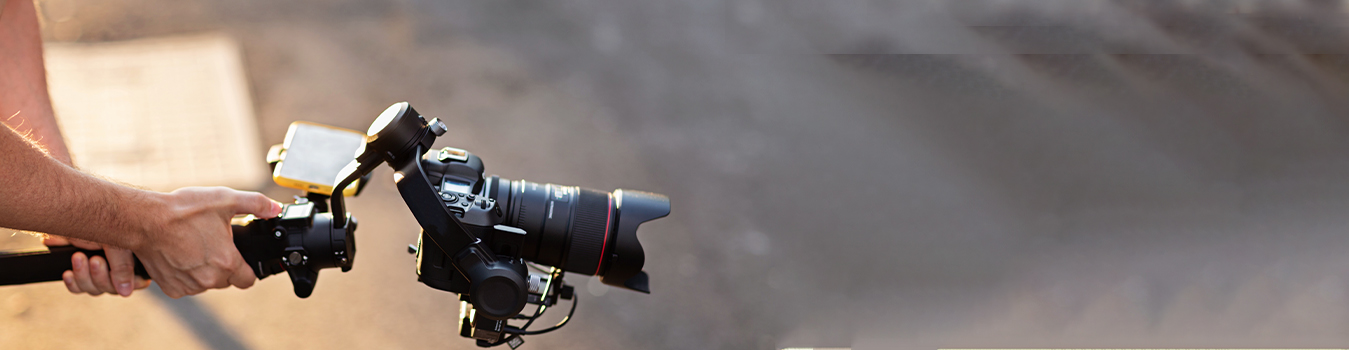
4K Resolution and Stabilisation
Professional real estate drone footage is captured at 4K resolution on stabilised platforms. DJI professional-grade equipment including the Inspire 2 and Mavic 3 Pro are the industry standard. Footage from consumer-grade drones at lower resolutions produces visible quality differences on the large screens and high-resolution displays where real estate content is viewed.
Post-Production: Colour Grade and Edit
Raw drone footage requires colour grading, stabilisation, and edit sequencing before it becomes usable content. Professional post-production produces consistent warm tones, accurate colour rendering, and a sequence that tells a coherent story from approach to overview to neighbourhood context.
Music and Pacing for Property Video
Pacing should match the tone of the listing. Luxury residential properties suit slower, cinematic pacing. Housing society master plan videos suit a more energetic pace that conveys scale and momentum. Music selection and pacing are creative decisions a professional team makes deliberately rather than defaulting to stock choices.
What to Look for When Hiring a Real Estate Drone Company in Islamabad
CAA Licensed and Compliant
Ask directly and ask for documentation. Every professional real estate drone operator in Islamabad should be able to confirm their CAA certification immediately. This is the first and non-negotiable criterion.
A Real Estate-Specific Portfolio
Review completed real estate drone videos, not generic aerial footage. Real estate work requires specific shot types, pacing, and post-production sensibility that general aerial work does not always reflect. Ask for three to five complete real estate examples before booking.
4K Capable Professional Equipment
Confirm the specific drone model and resolution in writing. Professional real estate work requires 4K minimum. Ask about gimbal stabilisation and how footage holds up in mild wind conditions, which are common in Islamabad in spring and autumn.
Strong Post-Production Quality
Ask to see finished, delivered examples rather than raw footage. The colour grading, the edit sequencing, and the music selection in finished examples tell you more about a company’s actual capability than their equipment list does.
Transparent Pricing and Written Deliverables
Confirm in writing: flight hours, locations covered, permit costs, number of edited clips, delivery format, turnaround time, and usage rights for commercial marketing.
Best Real Estate Drone Videography Services in Islamabad 2026
1. Hamza’s Production
Best For: Housing society marketing, premium residential listings, commercial real estate, construction documentation, integrated aerial and ground-level real estate video
Hamza’s Production delivers drone photography and videography services as part of a complete real estate video production capability. Their aerial work is not produced in isolation. It is planned alongside ground-level property photography and videography so the final marketing package is coherent from the first interior shot through to the final aerial overview.
Their licensed operators manage all CAA permit requirements for Islamabad shoots. Their post-production quality reflects the standards premium real estate marketing demands. For developers needing hotel and property video production with aerial capability, Hamza’s Production delivers both from a single team. Their corporate video production services extend to investor presentations and housing society launch films where aerial footage is a planned element.
Location: Lahore, Pakistan (nationwide including Islamabad)
2. SkyView Productions, Islamabad
Best For: Developers and agents marketing properties in E-7, F-6, and northern Islamabad sectors where Margalla Hills context is a key selling point
SkyView Productions operates from Islamabad with strong experience in northern sector shoots. Their local presence gives them faster permit turnaround and familiarity with the shooting conditions specific to northern Islamabad sectors.
3. Aerial Eye Pakistan
Best For: Housing society developers in Islamabad needing regular, consistent aerial coverage across large multi-phase projects
Aerial Eye Pakistan structures its operation for high-volume real estate aerial work. Their workflow suits developers needing consistent documentation across multiple phases throughout a development cycle.
4. PropLens, Islamabad
Best For: Property agents and brokers in Islamabad marketing individual premium residential listings
PropLens focuses on single-property shoots for agents and brokers across Islamabad’s established sectors. Their packages are built specifically around individual listing requirements rather than large-scale development documentation.
5. Vista Drone, Islamabad
Best For: Construction firms and commercial developers needing systematic aerial progress documentation across active Islamabad project sites
Vista Drone has built specific capability in construction documentation and aerial survey work. Their consistent camera positioning across shoot dates enables direct visual comparison for investor and financier reporting.
Real Estate Drone Videography Pricing in Islamabad 2026
A single-property shoot covering an overview, orbit, reveal, and neighbourhood context with colour-graded clips typically costs between PKR 40,000 and PKR 90,000.
A combined aerial and ground-level listing package with a one to two minute edited video typically costs PKR 90,000 to PKR 200,000 depending on scope.
A housing society package with master plan footage and a three to five minute marketing video typically costs PKR 150,000 to PKR 400,000.
CAA permit fees add PKR 10,000 to PKR 30,000 for standard Islamabad locations. Construction documentation retainers typically cost PKR 40,000 to PKR 100,000 per visit. Always get a complete itemised written quote before confirming any booking.
How to Brief a Real Estate Drone Team
Five things must be clear before any shoot begins.
Your property details: share the address, sector, plot size, and any known airspace or access restrictions. A professional Islamabad operator will flag permit requirements immediately when they have this information.
Your marketing goal: end-users need reveal and lifestyle shots. Investors need master plan and progress footage. Overseas buyers need more neighbourhood context. Tell the team which audience they are shooting for.
Your shoot timing: confirm availability for golden hour windows. Early morning or late afternoon produces significantly better footage than midday.
Your deliverable formats: specify every format needed before the shoot. Landscape for website and YouTube, vertical for Instagram and TikTok, and compressed files for Zameen.com listing upload.
Your turnaround deadline: property listings are time-sensitive. Confirm a specific delivery date in writing before booking.
Frequently Asked Questions
Q1: Is drone videography legal for real estate in Islamabad?
Yes, with proper CAA authorisation. Commercial drone flights in Islamabad require operator certification and location-specific permits. Islamabad’s extensive restricted zones make licensed operators essential rather than optional. Always hire a company that manages permit applications as part of their service and can provide CAA documentation on request.
Q2: How much does real estate drone video cost in Islamabad?
Single-property shoots cost between PKR 40,000 and PKR 90,000. Combined aerial and ground-level listing packages cost PKR 90,000 to PKR 200,000. Housing society and large development packages cost PKR 150,000 to PKR 400,000. CAA permits typically add PKR 10,000 to PKR 30,000. For a personalised quote, contact Hamza’s Production.
Q3: What is the best time of day to shoot real estate drone video?
Golden hour, the 30 to 60 minutes after sunrise and before sunset, produces the best light for real estate drone footage. The warm, directional light at these times flatters both the property and the landscape. Midday shoots in Islamabad produce harsh, flat light that reduces the visual quality of the footage significantly.
Q4: Can drone footage be used for both marketing and construction documentation?
Yes. The same aerial footage captured for a marketing shoot can also serve construction documentation purposes when the shoot is planned to cover both requirements. Brief the operator on both needs before the shoot so they capture the specific angles and elevations needed for construction records alongside the creative marketing shots.
Conclusion
Real estate buyers in Islamabad have more listings to compare than ever before. Properties that show their location and setting from the air stand apart from those that only show rooms. Aerial footage communicates location value in three seconds that a written description cannot convey in three paragraphs.
The investment in professional drone videography is small relative to the value of the properties it markets. A PKR 90,000 aerial package on a PKR 30,000,000 plot is a rounding error in the marketing budget but produces the first thing a serious buyer sees. First impressions in real estate are not easily recovered.
For drone photography and videography services in Islamabad that are legally compliant and built around real estate marketing goals, Hamza’s Production is where to start. Get in touch today.


Leave a Reply